


Antique Map of Ireland — Mercator & Hondius, Amsterdam 1634 (Dutch-text edition)
Medium: Copperplate engraving, hand-coloured, 476 × 300 mm, with full Dutch descriptive text leaves. Text leaves on reverse.
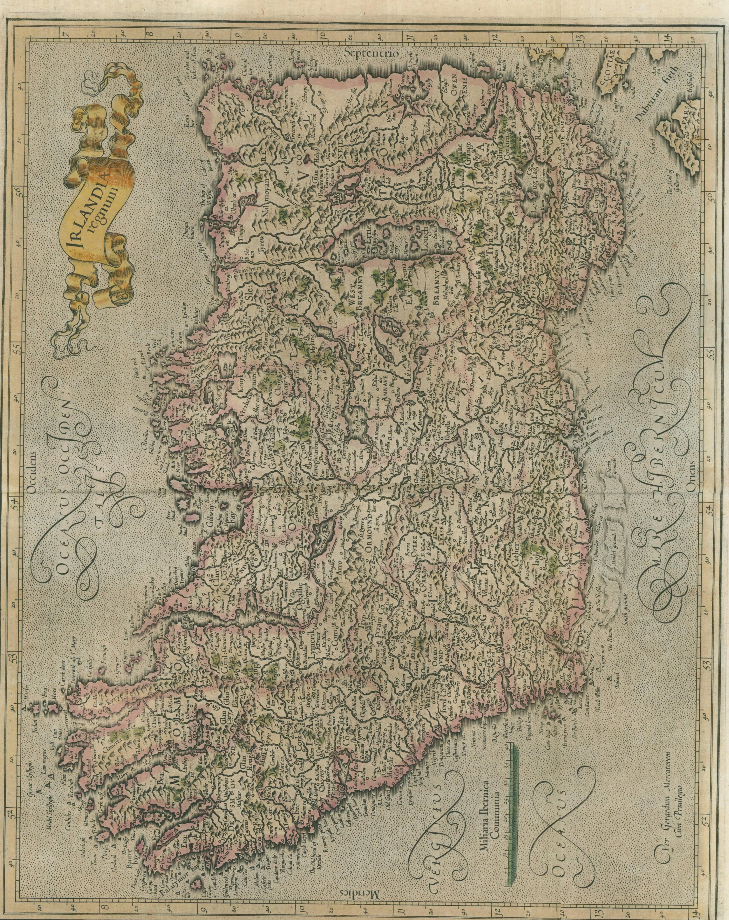
An exceptionally rare Dutch-text edition of Gerard Mercator and Jodocus Hondius’s celebrated Irlandia map, published in Amsterdam in 1634. Unlike the more common Latin editions, this example preserves the complete Dutch descriptive text (Beschryvinghe van YRland), which includes one of the few continental printed references to Ireland’s Iberian origin myth. The text attributes the name Hibernia to “Hibero, a Spanish commander,” echoing Ireland’s medieval Book of Invasions and offering a fascinating bridge between Irish myth, classical geography, and Dutch Golden Age scholarship.
Hand-coloured and printed from Mercator’s original copperplate, this is both an exquisite work of early modern cartography and a rare cultural artefact. The map is enhanced by its thematic marginal notes (Name’s Origin, Borders, People, Birds, Beasts, Fish), which guided Dutch readers through Ireland’s geography and lore in an engaging narrative style absent from the Latin editions.
Unframed, with both full Dutch descriptive text leaves on the reverse. Crease from original atlas. Scarcer than the Latin edition, this 1634 Dutch-text example is one of the few printed European sources to preserve the Iberian origin story of Ireland — a bridge between Gaelic myth and Dutch Golden Age scholarship.
Medium: Copperplate engraving, hand-coloured, 476 × 300 mm, with full Dutch descriptive text leaves. Text leaves on reverse.
An exceptionally rare Dutch-text edition of Gerard Mercator and Jodocus Hondius’s celebrated Irlandia map, published in Amsterdam in 1634. Unlike the more common Latin editions, this example preserves the complete Dutch descriptive text (Beschryvinghe van YRland), which includes one of the few continental printed references to Ireland’s Iberian origin myth. The text attributes the name Hibernia to “Hibero, a Spanish commander,” echoing Ireland’s medieval Book of Invasions and offering a fascinating bridge between Irish myth, classical geography, and Dutch Golden Age scholarship.
Hand-coloured and printed from Mercator’s original copperplate, this is both an exquisite work of early modern cartography and a rare cultural artefact. The map is enhanced by its thematic marginal notes (Name’s Origin, Borders, People, Birds, Beasts, Fish), which guided Dutch readers through Ireland’s geography and lore in an engaging narrative style absent from the Latin editions.
Unframed, with both full Dutch descriptive text leaves on the reverse. Crease from original atlas. Scarcer than the Latin edition, this 1634 Dutch-text example is one of the few printed European sources to preserve the Iberian origin story of Ireland — a bridge between Gaelic myth and Dutch Golden Age scholarship.